Before
Cragside, Northumberland
GVR Geo Helps Safeguard the Water Legacy of Cragside for the National Trust
Illuminated by hydro-electricity and powered by hydraulics, Cragside was the pioneering “smart home” of its day. It was filled with ingenious Victorian gadgets designed for efficient, modern living. Beyond the house, man-made lakes, tumbling waterfalls and sweeping swathes of rhododendron create a dramatic 1000-acre estate imagined and engineered by visionary inventor and armaments manufacturer William Armstrong and his wife, Margaret Armstrong.
When the National Trust sought to restore key water bodies within this Grade I registered landscape, GVR Geo was proud to be appointed as trusted technical partner on one of the Trust’s flagship properties.
A landscape where water is everything
At Cragside, water is more than a picturesque feature — it is the estate’s engineering heartbeat. Armstrong harnessed the natural topography to store, move and create power from water across the site, combining beauty and function in equal measure. The lakes and burns are as significant to Cragside’s story as the house itself.
Over time, however, natural processes had begun to compromise that vision. Siltation and marginal vegetation encroachment were:
- Blocking channels
- Obscuring originally calm reflective pools
- Reducing flood storage capacity
- Diminishing key views and visitor experience
The National Trust’s ambition was clear: return the lakes and watercourses, including Debdon Burn and Slipper Lake, to a condition and appearance the Armstrongs themselves would recognise, while strengthening their long-term resilience.
Delivering that vision required deep technical expertise, sensitive heritage awareness, and meticulous environmental management.
GVR Geo’s approach
GVR Geo was commissioned to undertake a comprehensive assessment and develop a robust, sustainable and deliverable strategy for restoration.
Our multidisciplinary team undertook:
- Detailed topographic surveys
- Water-based sediment probing and sampling
- Laboratory chemical analysis
- Soil and waste classification
- Regulatory liaison and environmental permitting strategy
- Risk assessment, construction planning and H&S coordination
Operating within a historic engineered landscape demanded precision. Though naturalistic in appearance, many lake margins and water features were man-made. It was critical that works remained within original channels and preserved Armstrong’s design features, including stream bed water-splitting boulders and the clay-plugged sandstone joints forming Slipper Lake’s former quarry bed. Our investigations verified archival notes from the estate’s former head gardener, which confirmed the Victorian ingenuity that ensured the quarry-formed lake retained water. A fantastic 19th-century engineer’s signature rediscovered through 21st-century ground investigation!
Working in a living, breathing estate
Cragside remains open to visitors year-round and the National Trust actively embraces the visibility of conservation in action. While enriching the visitor experience, this created considerable logistical complexities:
- Working within pristine water bodies
- Managing pollution risks in active watercourses
- Operating beneath live overhead cables
- Navigating steep, restricted access routes
- Working around nesting birds and foraging otters
- Avoiding stands of Japanese knotweed
- Maintaining safe visitor and works segregation
Close collaboration with Tilhill Forestry, the National Trust’s specialist forestry contractors, was crucial in enabling access and temporary clearance in sensitive locations. Their care and attention to detail was exceptional.
Sustainable engineering, true to Armstrong’s spirit
Sustainability was central to project delivery.
All plant used on site operated on biodiesel, contained biodegradable, vegetable oil-based hydraulic fluids and was maintained to the highest environmental standards.
Innovative filtration systems were deployed using geotextile-wrapped straw bales, securely pinned to river and lake beds. This allowed natural flow through the hydraulic control structures and weirs while preventing downstream debris and silt release.
Through regulatory liaison and reviewing existing Waste Exemptions, GVR Geo ensured that all dredged materials were retained and reused on site for riverbank and landscape restoration which eliminated landfill disposal and significantly reduced carbon emissions as well as negative impacts on rural roads of traffic, noise and mud whilst minimising ecological disturbance.
In advance of in-channel works, estate engineers enacted a controlled partial drawdown of the estate dam via the hydro-electric Archimedes Screw system. This lowered downstream flows, increased stormwater capacity, and fittingly, generated renewable power to partly offset the carbon consumption of the works. It was a solution Armstrong himself would surely have admired.
Tangible results and a vision for the future
Over two summer seasons, GVR Geo has supported restoration at:
- Slipper Lake — elegantly shaped like a 19th-century lady’s slipper
- 400m of Debdon Burn between the Iron Bridge and Tumbleton Dam
Choked and stagnant sections have been transformed into open, flowing water once again; enhancing views, reinstating flood capacity and revitalising habitats for kingfishers, otters and aquatic life.
Future works will focus on Tumbleton Lake, where recent sediment and vegetation surveys have prepared the ground for the next phase of water body restoration.
A flagship partnership
Christopher Clues, Head Forester at Cragside Estate, commented: “The Debdon Valley, its burn and Slipper Lake are part of William and Margaret Armstrongs’ meticulously planned fantasy mountain landscape.
“The Valley in particular, plays an integral part in how we demonstrate that Cragside is a grand engineered garden. Already an original waterway, the burn was shaped by a huge Victorian workforce to create a picture-perfect scene through the heart of the grounds with the creation of decorative pools, equidistant weirs, and rugged water features. Over-time, these were being lost to over-growing reeds and a build-up of sediment.
“GVR were conscious that work was taking place while we were open during a busy spring/summer season to take advantage of lower water levels and ground conditions. The Debdon Valley is arguably the most visited area on the grounds and a main route between the visitor centre and House.
“Their detailed project plan helped us to communicate what was happening to visitors and why they were being diverted during such a key time of year. GVR Geo were integral to ensuring the works ran smoothly in both areas. They liaised with stakeholders efficiently and professionally supporting the Forestry team at Cragside.
“Their work was carried out in a sustainable way with environmental best practice at the forefront. Their care and attention to detail was exceptional, especially while working within such a complex historic site. We will look forward to working with them again on future projects.
Grant Richardson, Director at GVR Geo, reflects: “Four members of the GVR Geo team had the privilege of delivering this project, and we are immensely proud to have played a part in safeguarding such an important national heritage asset. Working alongside a passionate and highly skilled National Trust and contractor team has been a genuine pleasure.”
Engineering heritage. Protecting the future.
Cragside is not simply a visitor attraction, it is a nationally significant demonstration of Victorian innovation, landscape engineering and sustainable water management.
For GVR Geo, this project showcases what we do best:
- Technically rigorous ground investigation
- Sensitive heritage-led engineering
- Environmental risk management
- Practical, buildable solutions
- Seamless stakeholder collaboration in sensitive environments
If you would like to learn more about how GVR Geo can support your water, environmental or heritage-led ground investigation projects, we would be delighted to talk.
Get in touch with the team at GVR Geo. For further information on Cragside, please visit https://www.nationaltrust.org.uk/visit/north-east/cragside.
Before and After project photos:
Photography credit BM Forest & Land Ltd & Tilhill Forestry.
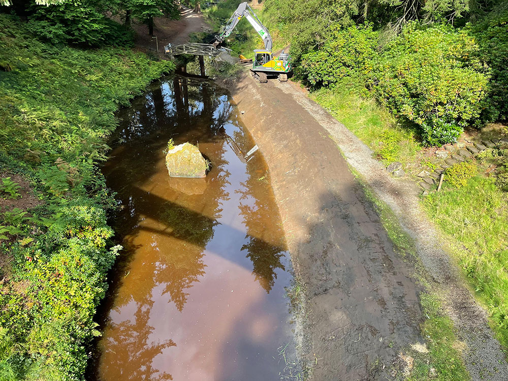
Debdon Burn South
After
Before and after at Debdon Burn south, demonstrating the extent of siltation and revealing the stream-splitting boulders placed by Armstrong for dramatic effect.
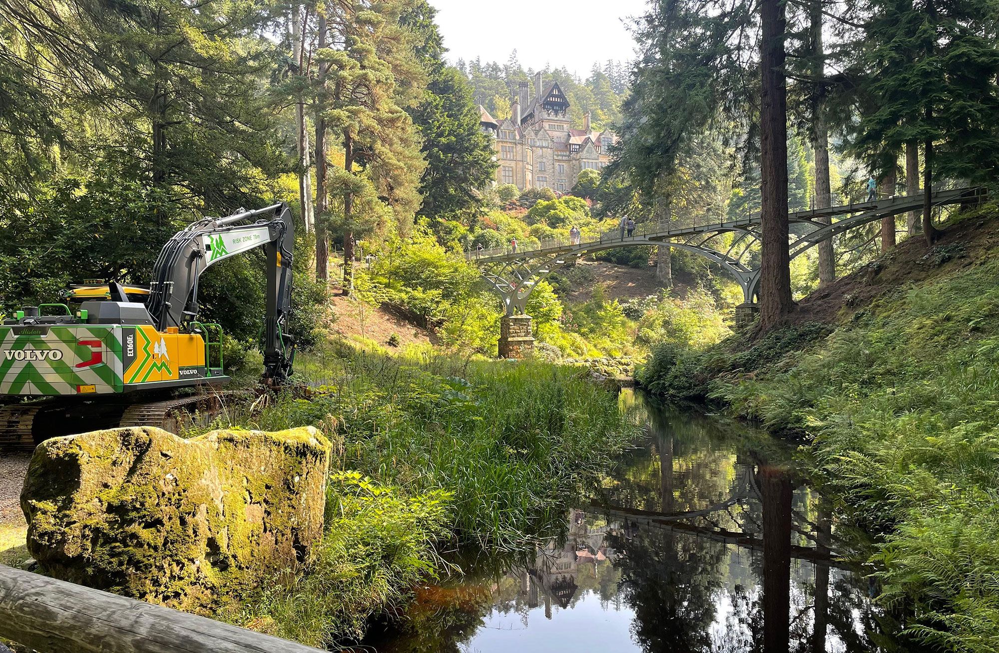
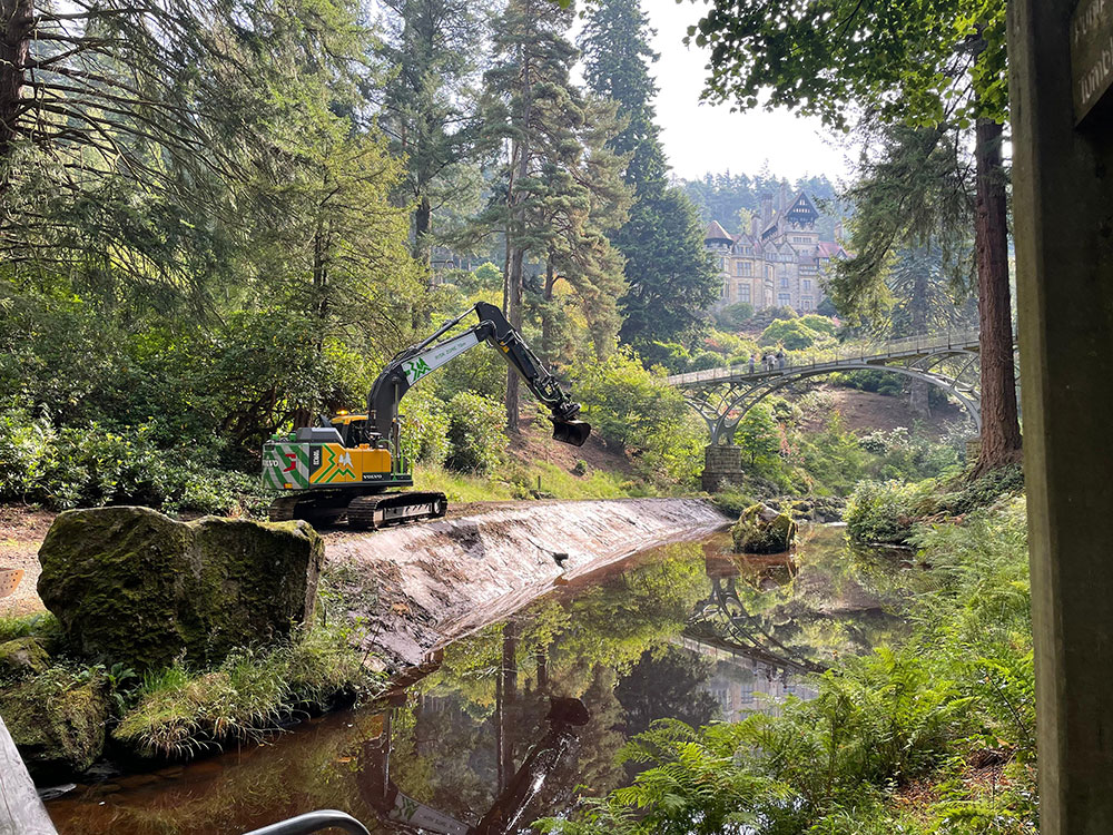
Debdon Burn & Bridge
Before
After
Debdon Burn looking south to the Grade II listed Iron Bridge, restoring the watercourse and the full extent of the stunning arch reflected in the cleared water.
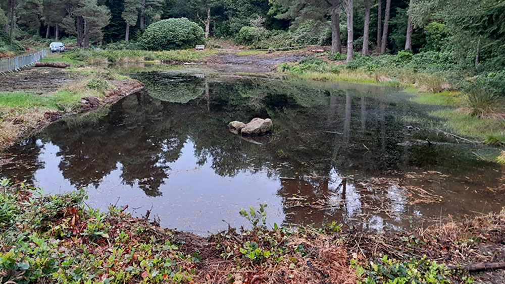
Slipper Lake
Before
After
Slipper Lake looking north showing a dramatically widened and improved water surface towards the end of the works.
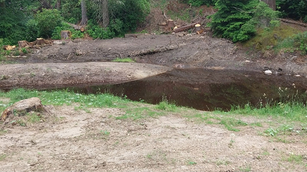
Debdon Burn North
Before
After